A beautiful day for a bike ride! Our route took us 30 miles north of Mitchell through rolling grasslands with occasional rock outcroppings.

At the visitors' center we learned that James Cook owned a ranch here. It was a stopping place for travelers and

later, the summer campground of Chief Red Cloud and others.


The ranch is still owned by the family. Here is the Bone House, his original house on the left that later became the paleontologists' house, and the new ranch house as it looked in 1923.

When out riding one day James Cook noticed something odd sticking out of the rock formations below. He invited paleontologists for a look. They decided (over the years) that the whole area was once on the same level.
Sometime between 1/3 million to 10,000 years ago the Niobrara River began carving a broad valley through what is not Eastern Wyoming and Northern Nebraska. As the river cut down through the plain, it exposed layers of gray sandstone, shaping them into cliffs and buttes. These rock layers are much older than the Niobrara and reveal how the environment both sustained the animals that roamed the area 19 million years ago and then preserved their fossil remains.

Paleontologists have concluded that these sedimentary rocks were formed in an ancient water hole. The water hole was eventually buried by stream sediments during periods of drought. As the water hole grew smaller, the animals were forced to walk further away for their food, then walk back for water. Eventually they became too weak to make the trip and died. The rapid deposition of ash and sand provided a perfect environment for fossil preservation. They both covered the remains of ancient mammals quickly and produced an alkaline chemical environment which stabilized the bones. Many of the bones went to other museums, but many remain in the visitors' center museum.


I think the round rock is fossilized grass roots.

Two of the many types of animals that left fossil remains.


View from the top. The valley is about 150 feet below. (The valley is about 4500' above sea level.)

After our 2.7 mile round trip hike to the buttes and back, were were ready to refill our water bottle. We like the new machines that keep popping up at these museums. This is our new favorite.

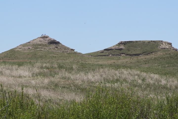
Refreshed, we were ready for our next hike. Three miles down the road a gravel path snaked its way up to and around the left of the flat butte and up the back side, then down between it and the conical butte on the right.

Sedimentary rock is a term for rocks that are either the accumulation of grains such as silt, sand, or pebbles, or that were left after fresh or salt water evaporated. This dune is all that remains of an extensive sand dune field. The sandstone was formed from wind-blown sand.

The main attraction along this 1/2 mile loop is a fossil originally called a Devil's Corkscrew. Paleontologists called it that because they couldn't at first decide what it was.

After further observation it was discovered that they are the remains of burrows made by an ancient terrestrial beaver with the social behavior of a prairie dog.


View from the top. Three miles in the distance are the two fossil buttes we visited first.

Enough of rocks! Here are some animals we saw within the monuments.
swift

This plain looking grasshopper displayed beautiful peach patches when it flew away.

Tiny horned lizard

Eastern cottontail rabbit. We didn't think to ask why Eastern Cottontails were abundant in the west.

Outside the park we caught glimpses of antelope.

These were running at about 45 mph.

Lone sentinal

As we entered the fairgrounds, we saw several peacocks that were visiting from over the fence.

I don't know which we liked best--learning about the amazing way this area was formed or the wonderful ride in perfect weather on practically deserted roads!
One more day of exploring.
Louise and Duane
No comments:
Post a Comment