After our swing through California, Nevada and Utah we settled in at Escapees North Ranch RV park where we will be workcamp til the end of February. We have taken a lot of motorcycle rides around here but they have been repeats of other rides we have posted about, so I didn't post about them. We hope to ride to Oatman and Lake Havasu in the near future and will post about that.
My computer crashed last week and I had to get a new one. Now I have to get all the programs that I used loaded back on. I took the computer in to a service center and they were able to recover some of the pictures of our travels but we lost a LOT. Of coarse the programs I have are 5 years old or older and don't want to load on the new one. This has not been a good week. Along with trying to get the new computer set up I have been carving this years grand kids Christmas ornaments. I better get busy, huh.
The other news we traded our 5th wheel in for a new one. Every since the wreck I have been worried about towing the old one. We now have a Raptor Toyhauler, pictures to come later. That's it for now.
Duane and Louise
Wednesday, December 03, 2014
Monday, September 08, 2014
Cottonwood Base
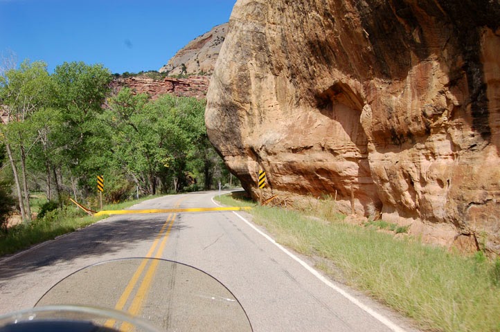
While we have been in the Verde Valley Thousand Trails rv park just outside Cottonwood AZ, we have taken advantage of the clear weather to take a few bike rides. Most have been short ones around here, i.e. to Cottonwood for Duane's birthday dinner, or to the grocery but we did take a couple of touring rides. One was to the city of Sedona. This is a beautiful city surrounded by towering red rock mountains. The city is well maintained and pretty, even in the residential and business sections. The first of our rides took us to the old (tourist) section. We parked on the street and walked up and down the street past the usual galleries, restaurants, and boutiques.

street art

playable street art

We found the HD boutique store and had a cool soda in a pizza/sandwich place, then hopped the bike for Oak Creek Canyon. This is a beautiful ride in any kind of vehicle. The road follows the creek bottom for miles. There are lots of little camping areas on either side. At the end of the canyon the road veers left and starts to climb.

At the top is a large paved area that is part parking lot with a little forest service info center, and a dozen or so booths run by Navajo artists selling their wares. Below is the road we took to the top. If you click on the pic and enlarge it you can see four levels of road.

After we cooled off and walked around a bit we rode through upland woodlands and meadows until we reached Flagstaff.

We rode through Flagstaff and picked up I17 to the outskirts of the town of Belmont and the Grand Canyon HD store for a browse. Duane got a long sleeved tshirt for his birthday.

Back to Flagstaff for lunch. Flagstaff is about 6900 ft. in altitude. This is the highest we reached on our rides around here.

Another daylong ride took us to three National Sites.

This is a fanciful name that stuck. Actually Montezuma was born long after this cliff dwelling was build and probably never visited it, but the people who named it thought it looked like an Aztec building and the name stuck.

The 'castle' is actually the highest building of a whole complex. There are hundreds of such dwellings throughout the Verde Valley. Small structures and later pueblos (villages) rose along major streams. (The three sites we visited are situated along the Verde (Vare-day) River.
The partially restored 'castle' , 100 ft up the cliff face, the contains 20 rooms on five levels. The holes in the wall right, center, and left under the 'castle' are post holes that supported roofs and up to five floors of several other multi-room dwellings.


This is a beautiful site with a nice Visitors' Center/gift shop and a paved loop walk past the ruins, down to a view of the river, around to a shelter used for picnics and ranger talks, and ends at a large diorama showing the interior of the castle. When the Natives lived here the area between the houses and the river was farmed.
Next stop was a natural spring fed lake.

Water percolates into the limestone Mogollon Rim (in the distance) and flows as an underground stream that narrows into two springs that feed this lake. Every day the Well is replenished with 1.5 million gallons of new water. The water flows through a long narrow cave (at water level at the right of the pic) and reappears on the other side. There is a trail down to the water running along the right side of the lake.

Cliff dwellings just to the left of the pic above. More ruins appear at water level around the well and directly across from these on the rim. There is another nice paved trail to these dwellings and down to the river on the other side of the rim.

water level ruins

People must say "I was here". By law this graffiti is protected because it is over 150 years old.

This is where the water reappears on the other side of the rim. The natives dug an irrigation channel for it that carried it to their fields. Unfortunately, the water had high levels of arsenic. It would have been better to use the river water.

For our last stop we took the scenic, 4 mile gravel road. Other than a few teeth jarring washboards, the road was pretty decent, even on the bike. The road joined the paved road that led us toward those hills.

This area was used as a gathering area for native Americans, principally Hopi and Navajo for hundreds of years before it became a cattle ranch and finally a National Heritage site

This is all that is left of the ranch house. To the right is the small but very nice Visitors' Center. To the left is the dirt trail that leads about a third mile to the pictographs. The Forest Service is very protective of this site. It is gated and locked when not open and only open 4 days a week. You have to make an effort to reach the place, and probably wouldn't bother if you didn't know what it was. It is very well kept. There is a work camping couple and a volunteer couple that man the visitors' center and give talks at the site.


Most of these messages are a mystery. Some Hopis have explained that the Heron, Scorpion (upper right, look like turtles) bear and other clans left their calling cards. Some of it is story, usually circular running bottom to top counter clockwise. Some of it is solar calendar designating planting seasons. There are no dwellings here. Apparently this was used as a gathering place only.

Hot but happy we exited our ruins tour and headed for Oak Creek Village, just outside Sedona. This route was was very scenic.

This is why people visit Sedona--a view wherever you look!

Both Oak Creek Village and Sedona take great care with their buildings and houses so that they don't detract from the view. Our route took us through this side of Sedona, then on home.

Just outside the park entrance is a packed gravel road to the left. We took it down the hill to a little vineyard. The vines are planted on top of the hill in the center and on the right side of the road. The building is located behind the hill. It houses a nice restaurant/tasting bar and gift shop. We looked but didn't buy this trip.

Our tour time is almost over. Soon we will be heading back to Congress to work camp and spend the winter. If the weather cooperates, we may get in one more bike ride to one more ruin site.
Stay tuned!
Louise and Duane
Monday, August 25, 2014
Last day at Arches
Today was get-in-free day at all National Parks. We thought we might have to fight for space in our last couple of hikes in Arches, but we got there early enough to miss most of the crowds. We had seen most of the sites on our previous two visits, but there were a few short ones we wanted to complete.

The first was to Sand Dune Arch. This was fun because the walk was short, cool and took us through a slot.


Owl (we think) nest in one of the many holes in the rock. We know this is a nesting site because of the white poop in front.

From the Sand Dune the trail led across open grassland to Broken Arch.

We didn't get on the trail until almost ten but saw some wildlife which has proven very difficult on our previous hikes.

Mule deer

This arch isn't really broken but was called that because it appeared broken from a distance.

Next stop was North Window

and
South Window.

Unnamed arches

Turret Arch

The windows trailhead started from the upper parking lot.

From the lower parking lot was a trail on the other side of the road that went to Double Arches. I chose this view for the perfect shade of blue above the top arch.

After lunch we headed down Scenic Byway 291 for an Indian Rock Art tour. This means petroglyphs which are motifs that are pecked, ground, incised, abraded, or scratched on the rock surface, and pictographs which are paintings or drawing in one or more colors using mineral pigments and plant dyes on the rock surface. We followed Long Canyon which features art dating from 5300 BC to 1880 AD.
This is a favorite rock climbing area before the rock art begins.

Pictographs

Long Canyon was carved out by the Colorado River. Below is the river road, the vehicle road and the railroad.

Jug Handle Arch. We were unable to find the art here, but enjoyed the arch.

The white marks are the three-toed tracks of an Allosaurus.

To the left of these tracks are the petroglyphs which look like cut-out dolls.

We enjoyed a lot of art on this tour, but by the time we reached the end of the Canyon we were hot and tired. We decided to save the three sites on the other side of the river for tomorrow.
You tired yet?
Louise and Duane
Sunday, August 24, 2014
Canyonlands National Park--Needles Area
Sunday dawned bright and clear with no chance of rain--a day made for the 67 mile ride to the entrance to Needles, one of three areas that make up Canyonlands National Park. Friday we did a driving tour of the north part of the triangle, Island In The Sky. Yesterday brought showers and thunderstorms all day so that we only ventured out for church and ice cream afterward. Today we opted to enjoy our rain-less day out.

The road from Moab to Needles has different rock formations. It comprises the south east corner of Canyonlands. The other corner is called The Maze and can be accessed only by river--the Green River in the north and the Colorado after the Green flows into it, by high-clearance 4-wheel drive vehicle, or by hiking.
The further south we went the more we encountered these shrubbery stuffed hills.

All over the Moab area parks and BLM lands (like this) we found these slickrock sandstone formations called beehives. Utah got its nickname from these formations. Its called the Beehive State.

The area outside Needles is BLM land. This area is open range and we crossed lots of these cattle guards.
Just along the road is a pull-off for this interesting area.

There are so many pictographs here that I imagined ancient peoples stopping along here to see where the good hunting was or to leave the latest news.

Duane and I are real rock lovers. We are suckers for unusual formations like these pillars.

Land of the grand mesas.

Unusual little pond. The ranger at the visitors" center commented that the summer monsoons started late this year. Ordinarily this would have been evaporated by this time.

We liked the design of the visitors' center which blended in with its surroundings.

There are lots of hikes of varying lengths and terrain here. We opted to ride all of the paved roads and take the short hikes from easily accessible trail heads. The first is called Roadside Ruin and led to this ancient grainery storage. The walk also pointed out various edible plants the ancient people would have used.

Hike two was to an historic cowboy camp at Cave Spring, so called because there is a perpetual seep here. In 1926 there was a successful cattle operation here. It took 200 acres to feed one cow and water sources were many rugged miles apart. Cowboys usually worked several weeks or months at a time. Each cowboy packed his belongings and moved from spot to spot as they moved the cattle around. This open shelter was better than out in the open. There are a series of overhangs along here. They were used by ancient peoples too, as evidenced by painted figures and grinding depressions on boulders (not pictured)

The trail let up two ladders to slickrock to point out various plants and animals that adapted to the hot arid area.

On the way to our next hike we passed a famous rock formation that forms a window. Can you see the wooden shoe?

The paved road ended in the Big Spring Canyon overlook. The 4 mile trail to the confluence (of the Green and Colorado Rivers) starts here. We opted to walk around the mesa top and photo the wonderful views.
These rock towers are called needles and give this area its name. I love them because it looks like a large city out there.

Water runoff carved out this canyon/basin.

Love the hoo-doos

From Big Spring Canyon we tootled back down the road to a picnic area for lunch, then a little farther on for our last hike, Pothole Point. Potholes (originally called cenotes) are left in the slickrock surface erodes unevenly. The depressions hold water from the monsoons until the water evaporates. Birds, mammals, and reptiles depend on these temporary pools. They are also home to tiny plants and animals. Each pool is a complete ecosystem. The life cycles of these organisms is accelerated. Within hours eggs hatch and within days life becomes visible. Crustaceans, tadpoles, worms and insects live in the tiny world. After the water evaporates, some organisms survive as eggs that lie dormant within the cracked mud. A few, such as snails, are able to survive as adults by sealing themselves within their shells.
Below is a tadpole shrimp and a snail.

Not sure but I think this is a fairy shrimp. It is about 1/4 inch long.

On our way out we saw a rather large herd of cattle on both sides of the road. Since this is open range, we had to be sure all of them were well away from the road and not apt to wander in front of us.

The road home passed Wilson Arch.

We really enjoyed our visit to Needles and recommend it as a must see for everyone. It is well worth the trip.
More hiking in our future? Depends on the weather.
Louise and Duane
Subscribe to:
Posts (Atom)