Tuesday, June 16, 2015

I'm back

I promise I will try to better with the blog.  We sat in Congress, Arizona at NorthRanch RV park while we work there for 5 months. Not a whole lot going while we were there. I played a lot of pickleball and took a lot of day trips on the bike.
We left Congress in March and headed to Texas to visit our three boys and their families that lived there. I also thought I had to take another driver's test because of the size of our truck. I made the appointment, I had to wait 3 weeks to get in. When I got there and the lady looked at all the weigh info on our trailer and truck I was told I did have to take the test. THREE weeks  wasted, oh well.
We enjoyed visiting with all the kids and grand-kids. We got to meet Jesse's girl friend and her daughter.
Leaving Texas, we headed to Rend Lake in Illinois for a week of rest. While there we made several bike trips. Then it was on to Ohio. Our two daughters still live there. One in Cincinnati, the other in Troy. While in the Dayton area we caught with a lot of friends and family. For two weeks it was run, run, run. Many days we would have lunch with someone and dinner with someone else. Rachel and Benji have three kids so it was ball games most evenings. Leaving Troy, we stopped at Mogadore, Ohio to visit a lady that Louise worked with years ago. On to Jefferson, Ohio where we stayed at a Thousand Trail campground for a week to rest up.
Monday we moved to Lockport, New York Elks Club. We chose Lockport for it's location. It's an easy ride to Niagara Falls, the Erie Canal, Fort Niagara and the Genesee Living History Park. Today was spent at the Erie Canal Locks.
The Erie Canal is a canal in New York that originally ran about 363 miles (584 km) from Albany, New York, on the Hudson River to Buffalo, New York, at Lake Erie. Built to create a navigable water route from New York City and the Atlantic Ocean to theGreat Lakes, the canal helped New York eclipse Philadelphia as the largest city and port[1][2] on the Eastern Seaboard of the United States. The canal is now part of the New York State Canal System.
First proposed in 1807, its construction began in 1817. The canal contains 36 locks and a total elevation differential of about 565 feet (172 m). It opened on October 26, 1825.
                                                 We visited locks 34 and 35 today. 

The lift of the two locks are 50 feet.


After wandering around this area we went home for lunch, then went back to town to visit the Niagara Historical Society Museum.  This was a complex of 4 buildings--two large historical houses, one small one and a large barn.  The exhibits showcased the life, times and business that made the original town of Lockport.  After a couple of interesting hours, we were done touring for the day.

Tomorrow we head to Niagara Falls and Fort Niagara.

Till next time
Duane and Louise

Monday, February 09, 2015

Finally something to blog about

We have been working here at the park and have not done anything to to blog about. Our days consist of  working, 2 days a week, and playing a lot of pickleball. On the days I don't work, I go to the court at 7:30 AM and play till about 9 AM. I return to the court at 1 PM and play for a couple of hours. Louise goes to the court at 4 PM for about 2 hours of playing. Did I mention that I love the game.... We are nearing the end of our commitment here at North Ranch RV Park. We will leave here the end of February. 
We decided that w had better get busy and do the things that were on our list to do here before we had to leave. So this past Thursday we climbed on the bike and took off for Oatman, Arizona.   Oatman is a small mining town on old route 66 that reinvented itself  as a tourist trap. After the mines closed down it about turned into a ghost town. Now it is a famous destination along old 66 known for the wild burros that roam the streets looking for hand outs from the visitors. 

The road into the town winds through the mountains along old 66 with few guard rails and a lot of tight turns. 


Did I say a lot of tight turns


As soon as you get into the town, it is apparent what the attraction to the town is. The burros are all over the place. These burros are descendents of  the burros that were used in the mining operations of the area and were turned loose to fend for themselves. They are protected by the Wild Horse Act and are free to roam where they want. Some of the stores in town sells food to feed them. They have become very good at begging and seem to be quite tame.

The town is a destination for a lot of people including a lot of bikers.
 The red one is ours.


 The hotel is famous for the fact that Clark Gable and  Carole Lombard spent their honeymoon there. Gable returned there often to gamble with the miners.
 The stores in town are the typical tourist town gift shops selling tee shirts and knick-knacks. 
 We spent several hours walking around Oatman and going in and out of the stores. We ate lunch while there. 

When we were done touring the town we mounted the bike and took off for Lake Havasu City, Az. 

The city is on the shores of Lake Havasu and has grown into a winter destination for a lot of snowbirds. The city has a lot of motels and restaurants to choose from. We arrived in town about 4:30 in the afternoon and got a room at a Super 8 Motel. They only had one room available and only for one night. Luckily that was all we needed it for. We went out to eat at a Black Bear restaurant and returned to the room for the night.  We had to stop at the Harley store while out.

Friday morning we took off to tour the town.  The main attraction in town is the London Bridge.

The 1831 London Bridge was the last project of engineer John Rennie and completed by his son, John Rennie the Younger.[3] By 1962, the bridge was not sound enough to support the increased load of modern traffic, and was sold by the City of London.
The purchaser, Robert McCulloch, the chairman of McCulloch Oil Corporation, was the founder of Lake Havasu City, his retirement real estate development on the east shore of Lake Havasu, a large reservoir on the Colorado River. McCulloch purchased the bridge to serve as a tourist attraction to Lake Havasu, which at that time was far from the usual tourist track. The idea was successful, bringing interested tourists and retirement home buyers to the area.
 When one thinks of lighthouses, they rarely consider a landlocked state covered in desert like Arizona for their location, but it just so happens that Lake Havasu City is home to more lighthouses than any other city in the entire country. These 1/3 scale replicas are actual functioning navigational aids built to the specifications of famous East Coast, West Coast and Great Lakes lighthouses. More than eighteen can be seen on the shores of the lake. Most can be hiked to while some are only accessible by boat.
 Early afternoon we headed off for home. The scenery south along the lake  is really rugged and ever changing. 
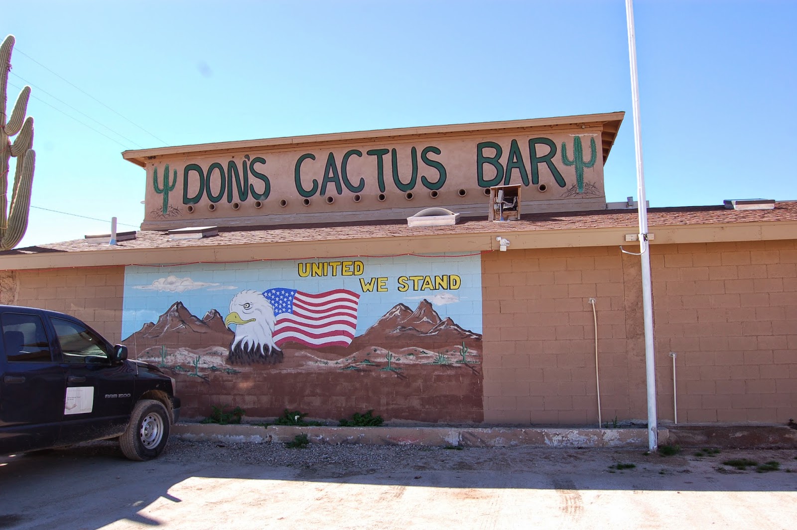
 We made a stop for a late lunch on the way home at Don's Cactus Bar. I had read that this is a popular stop for the biker clubs out of Phoenix. The food was pretty good.
We arrived home about 4 PM in time for a game of pickleball. We had a great time and saw some places that were on our list of places to see. We hope to find time for one more road trip before we leave here. 
Stay tuned to see if we make it.
Til next time
Duane and Louise

Wednesday, December 03, 2014

Sitting in Congress, Arizona

After our swing through California, Nevada and Utah we settled in at Escapees North Ranch RV park where we will be workcamp til the end of February. We have taken a lot of motorcycle rides around here but they have been repeats of other rides we have posted about, so I didn't post about them. We hope to ride to Oatman and Lake Havasu in the near future and will post about that.

My computer crashed last week and I had to get a new one. Now I have to get all the programs that I used loaded back on. I took the computer in to a service center and they were able to recover some of the pictures of our travels but we lost a LOT. Of coarse the programs I have are 5 years old or older and don't want to load on the new one. This has not been a good week. Along with trying to get the new computer set up I have been carving this years grand kids Christmas ornaments. I better get busy, huh.
The other news we traded our 5th wheel in for a new one. Every since the wreck I have been worried about towing the old one. We now have a Raptor Toyhauler, pictures to come later. That's it for now.
Duane and Louise

Monday, September 08, 2014

Cottonwood Base

While we have been in the Verde Valley Thousand Trails rv park just outside Cottonwood AZ, we have taken advantage of the clear weather to take a few bike rides.  Most have been short ones around here, i.e. to Cottonwood for Duane's birthday dinner, or to the grocery but we did take a couple of touring rides.  One was to the city of Sedona.  This is a beautiful city surrounded by towering red rock mountains.  The city is well maintained and pretty, even in the residential and business sections.  The first of our rides took us to the old (tourist) section.  We parked on the street and walked up and down the street past the usual galleries, restaurants, and boutiques.  


street art

playable street art

We found the HD boutique store and had a cool soda in a pizza/sandwich place, then hopped the bike for Oak Creek Canyon.  This is a beautiful ride in any kind of vehicle.  The road follows the creek bottom for miles.  There are lots of little camping areas on either side.  At the end of the canyon the road veers left and starts to climb.

 At the top is a large paved area that is part parking lot with a little forest service info center, and a dozen or so booths run by Navajo artists selling their wares.  Below is the road we took to the top.  If you click on the pic and enlarge it you can see four levels of road.

After we cooled off and walked around a bit we rode through upland woodlands and meadows until we reached Flagstaff.

We rode through Flagstaff and picked up I17 to the outskirts of the town of Belmont and the Grand Canyon HD store for a browse.  Duane got a long sleeved tshirt for his birthday.

Back to Flagstaff for lunch.  Flagstaff is about 6900 ft. in altitude.  This is the highest we reached on our rides around here.


Another daylong ride took us to three National Sites.  

This is a fanciful name that stuck.  Actually Montezuma was born long after this cliff dwelling was build and probably never visited it, but the people who named it thought it looked like an Aztec building and the name stuck.

The 'castle' is actually the highest building of a whole complex.  There are hundreds of such dwellings throughout the Verde Valley.  Small structures and later pueblos (villages) rose along major streams. (The three sites we visited are situated along the Verde (Vare-day) River.
The partially restored 'castle' , 100 ft up the cliff face,  the contains 20 rooms on five levels.  The holes in the wall right, center, and left under the 'castle' are post holes that supported roofs and up to five floors of several other multi-room dwellings.  


This is a beautiful site with a nice Visitors' Center/gift shop and a paved loop walk past the ruins, down to a view of the river, around to a shelter used for picnics and ranger talks, and ends at a large diorama showing the interior of the castle.  When the Natives lived here the area between the houses and the river was farmed.

Next stop was a natural spring fed lake.

Water percolates into the limestone Mogollon Rim (in the distance) and flows as an underground stream that narrows into two springs that feed this lake.  Every day the Well is replenished with 1.5 million gallons of new water.  The water flows through a long narrow cave (at water level at the right of the pic) and reappears on the other side.  There is a trail down to the water running along the right side of the lake.

Cliff dwellings just to the left of the pic above.  More ruins appear at water level around the well and directly across from these on the rim.  There is another nice paved trail to these dwellings and down to the river on the other side of the rim.

water level ruins

People must say "I was here".  By law this graffiti is protected because it is over 150 years old.

This is where the water reappears on the other side of the rim.  The natives dug an irrigation channel for it that carried it to their fields.  Unfortunately, the water had high levels of arsenic.  It would have been better to use the river water.

For our last stop we took the scenic, 4 mile gravel road.  Other than a few teeth jarring washboards, the road was pretty decent, even on the bike.  The road joined the paved road that led us toward those hills.

This area was used as a gathering area for native Americans, principally Hopi and Navajo for hundreds of years before it became a cattle ranch and finally a National Heritage site


This is all that is left of the ranch house.  To the right is the small but very nice Visitors' Center.  To the left is the dirt trail that leads about a third mile to the pictographs.  The Forest Service is very protective of this site.  It is gated and locked when not open and only open 4 days a week.  You have to make an effort to reach the place, and probably wouldn't bother if you didn't know what it was.  It is very well kept.  There is a work camping couple and a volunteer couple that man the visitors' center and give talks at the site.


Most of these messages are a mystery.  Some Hopis have explained that the Heron, Scorpion (upper right, look like turtles) bear and other clans left their calling cards.  Some of it is story, usually circular running bottom to top counter clockwise.  Some of it is solar calendar designating planting seasons.  There are no dwellings here.  Apparently this was used as a gathering place only.

Hot but happy we exited our ruins tour and headed for Oak Creek Village, just outside Sedona.  This route was was very scenic.

This is why people visit Sedona--a view wherever you look!

Both Oak Creek Village and Sedona take great care with their buildings and houses so that they don't detract from the view.  Our route took us through this side of Sedona, then on home.

Just outside the park entrance is a packed gravel road to the left.  We took it down the hill to a little vineyard.  The vines are planted on top of the hill in the center and on the right side of the road.  The building is located behind the hill.  It houses a nice restaurant/tasting bar and gift shop.  We looked but didn't buy this trip.

Our tour time is almost over.  Soon we will be heading back to Congress to work camp and spend the winter.  If the weather cooperates, we may get in one more bike ride to one more ruin site.

Stay tuned! 

Louise and Duane