For our second day of touring the Savannah area, we focused on historical forts along the Lower Savannah River below the city. First stop was Old Fort Jackson, Georgia's oldest standing brick fort. This fort was one of the national defense system of fortifications to defend the new nation. It was originally one of several mud forts constructed during the Revolutionary War. Our tour started in this little gift shop. From there we went out the back door to the pier.

View of Savannah on the left and the bridge from South Carolina to Georgia on the right. The site waschosen to protect Savannah. A ship traveling up the river must pass this point.

Our first view of the fort.

The five flags that flew over the fort. Notice the fifteen stripes on the foremost flag.

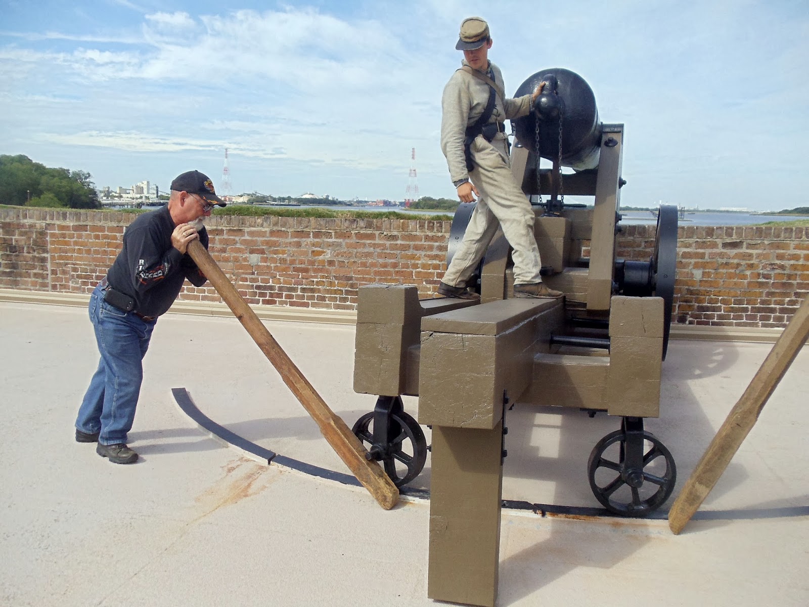
Our Confederate soldier guide demonstrating drum calls,

and big gun movement. The biggest guns were mounted on the upper tier of the fort. This gun could shoot as far as the red and white towers to the left of the soldier.
Flush toilet--the enlisted men to the left and right, officers in the middle. Twice a day, when the tide came in water was diverted to the fort via a canal and run under the privies and back out to sea.

At ground level the walls were pierced with shooting ports--small ones for rifles,

larger ones for smaller canon.

Reconstructed blacksmith shop

parade ground

Our next stop was the National Parks site of

This moated pentagonal fort was built on Cockspur Island. The moat is 7 ft. deep and from 32-48 ft. wide. The water was brought through a canal from the Savannah River and controlled by tide gates. This is the demilune or half moon of earthen mounds protecting the rear wall of the fort which housed the living quarters.

The fort was also guarded by a drawbridge, a wooden portcullis, and bolt-studded doors. Inside an inclined granite walk leads between two rows of rifle slits, past another set of doors and into the fort. Inside along this wall to the left were officers quarters. This triangular piece of land was flat during the war.

On the other walls were lined with gun casements.

View from atop the officers quarters. The 71/2 ft. thick walls at this angle were demolished by Union rifled artillery in 1862 forcing the Confederates to surrender the fort. This point was chosen for bombardment because it was in line with the powder magazine. Once breached, the magazine was a clear target. This was the only reason the Confederates would surrender the fort. The walls were repaired within 6 weeks after the surrender by federal troops. The entire upper tier was lined with far reaching smooth-bore guns which weren't as accurate as the federal rifle bore guns.

180 degree turn from the above pix shows the inside of the demilune. During the Civil War, this area was flat with a surrounding parapet and contained outbuildings and various storage sheds. The large earthen mounds, built after the war, overlay four powder magazines and passageways to several gun emplacements.

View from the breached wall. The federal guns that caused the breach were positioned on the far shore of the river behind the trees.

This bastion, which burned in 1895, shows the various construction details of the fort. Brick arches under the upper level upon which the cannons are mounted carry weight to counterarchesin the floor whick, in turn, are supported by a timber grillage and piling driven 70 ft into the mud. No wonder the fort was considered impregnable!

This canal was filled with river water to allow small boats access to the fort and to flush the privies.


Leftover ordinance

Having spent most of the day with our two forts, we decided to make a riding tour of Tybee Island. We used one of the public access walking bridges over the dunes to the beach on the Atlantic.

The water was cold.

Behind these signs are part of Ft. Screven which hugs the coast on two sides.


Across the street is Tybee lighthouse and its attendant buildings. This is Georgia's oldent and tallest lighthouse.


Between the fort and the lighthouse is a very nice self-pay parking lot.
Headed home, I found this sign at the entrance to Ft. Pulaski.

This is the Fort Pulaski lighthouse (the fort is out of sight on the left). There is a walking path down to the water from Ft. Pulaski, but I got this shot from the Tybee Island bridge. This lighthouse is not open to the public. It is maintained by the National Parks Service.

Next stop, Jekyll Island.
Louise and Duane
2 comments:
Now you hit a place we have never been to...Old Fort Jackson. What an awesome tour!
I think Tybee lighthouse is one of the first lighthouses I have ever seen. Boy, was that a long time ago.
How AWESOME! That is the kind of sites I like to see. I can't wait. We are slowly coming that way!
Post a Comment