 We entered the park on 117 and stopped at the ranger station. We learned that the area is a joint effort of the National Parks System and the BLM along with some private owners. It is bordered on the north by the Cibola National Forest and on the other sides by the El Malpais National Conservation Area. Our first stop was the Sandstone Bluffs Overlook Area. The large flat area to the left and center are lava flows dotted by vegetation.

Driving down this road the sandstone cliffs are on the left (east) this is a little natural arch.
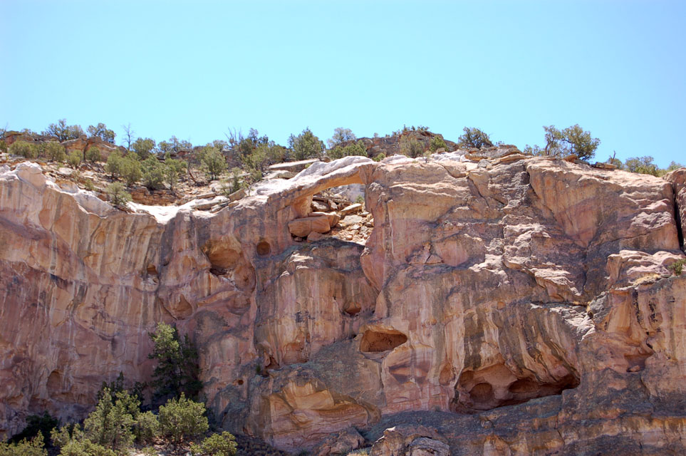 Farther down the road was our second stop--La ventana (the window) Natural Arch. The Sandtone Cliff overlook was reached by driving a mile down a washboard gravel road. The arch was an easy walk on a short trail. The arch is fenced off, but we had a good view.
To the left of the arch was a flat-faced rock. Duane swears the left hand blob is a charging buffalo. It took me a while, but I can see it.

On the other side (right) of the road were the ends of the lava flows. The lava flowed for up to 20 or so miles from the string of volcanoes on the north and west of the park. There were several different flows piled on each other over millions of years.
 Above and below, east and west sides of the road.
 This is part of The Narrows, where the flows ended very close to the cliffs. Just beyond this section of road the area opens up to grasslands, and the home of the prairie dogs. Some of the holes were right at the edge of the road!
Just past the grasslands we reached our final objective--the Lava Falls Area. This is a one mile walk over the flows. This is what I had come to see--what the main character in the L.L'A. story had to contend with. We grabbed our floppy hats, water and hiking guide and took off. We were amazed at how many different features we saw as we hiked along. The trail was marked by large cairnes, and 9 different points of interest. We learned the names of the different kinds of flow features and how they were formed.
 This flow is only 3000 years old and flowed over an older layer. It was like walking on clinkers.
 There was life everywhere: lichens, pinyon pines, wildflowers, cacti. Everything was stunted and low to the ground, but it was there. There were also lots of flies!
We gave this the technical name of "pudding".

This is what gave the hike its name--a lava fall. It was formed when one lava flow slowly dripped over the edge of a previous flow. The small recesses behind the fall is a perfect habitat for moss and algae.


Hiking along.
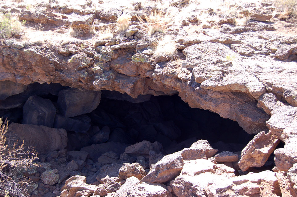
 By the time we got back to the truck, we were hot and hungry. All along this road are little picnic areas with pit johns. We opted to backtrack to the Narrows Picnic Area where the picnic tables are all covered. We cooled off and enjoyed our lunch before we decided to try the west side of the park. We drove part way west on old RT 66, then jumped on the highway to 53. We drove 20 south of Grants past cliffs on the right and grasslands on the left to reach the El Calderon Area. We wanted to see a lava tube, a lava lava trench, a cinder cone and a couple of "sinks". We didn't want to hike the three mile loop trail to see all of these features. We thought we could take the unimproved road around the area. Unfortunately the road was a jeep trail which means it was probably too narrow and rough for our big dually. We contented ourselves with viewing both ends of the lava tube, which was right there at the parking lot. Ordinarily we would have been able to crawl through, but all caves in the area are closed because they house bats, and because White-nose-syndrome is not in this area yet. This is actually a fungus that grows on the noses and wings of bats. It is not harmful to humans, but no one knows how it gets into the hibenation caves, so with the idea that humans may be intorducing it, all bat caves are closed!
It doesn't look like it but this is open through to both ends. It was formed by cooling lava collapsing and creating a tube. This one is about 10-15 feet long.

This completed our tour of El Malpais. I was satisfied that I could reread that story and get a really good picture of the area. We went back to Grants, hit the Wal-mart for a few groceries and got home about 5pm. Since we had food in the house again, we decided to walk next door to the casino for supper. LOL. It turns out that they have a featured buffet every night. Tonight was flat-iron steak night, cooked three different ways. For the bargain price of $12.99 we got steak, hot vegetables, baked or mashed taters, salad bar and desert bar. Yum yum, and I didn't have to cook it!
Tomorrow we move again, so stay tuned.
Louise and Duane
1 comment:
Awesome place! I love the Lava Falls. Another one to mark on our list to see. At this rate, we will be traveling until we are 90!
Post a Comment